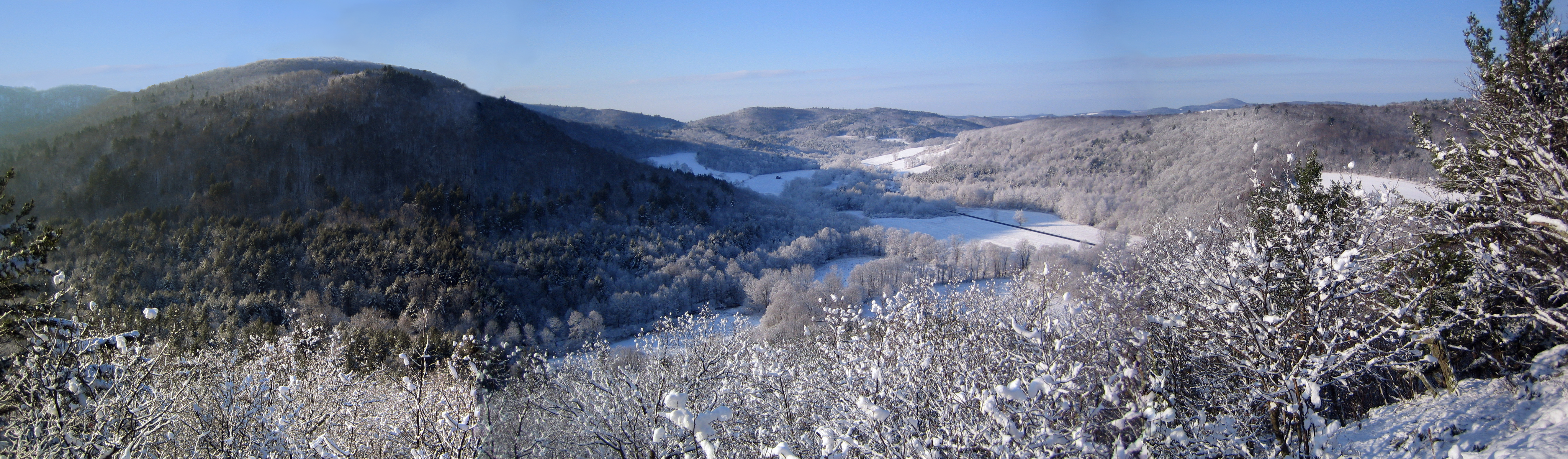
The Site

As some of you may know, I studied architecture in my early days. In fact I wanted to be an architect from an early age when I started copying plans out of ‘Better Homes and Gardens’ magazine. So after ten long years out of architecture grad school, I’m finally getting to design our own home. (If you recall from the very first post on this blog ‘Decision’, one of the reasons we decided to buy property was because we couldn’t imagine paying a huge mortgage to live in something that was never going to be what we really wanted.)
Well obviously I’ve been imagining all sorts of things in my head, but as the winter approaches and we take fewer trips upstate, I finally have some time on the weekends to start the formal design process. The first step in any architectural process is to study and model the site. After 3 months of exploration on the property, we believe we have two choices. That is to say the place we really want to the house to go, and the backup. We need a backup because the drive up to the ideal site will be expensive, both to put in and to maintain.
So first, the primary site. There are several practical considerations that must be satisfied, among them, 1) access to sunlight (e.g. south-facing). 2) Soil conditions that permit the digging of a foundation and installation of a septic system (affectionately referred to an an absorption field). As you recall, we have a lot of rock and ledge. 3) A location for the well up and away from the adsorption field. 4) Proximity to the future barn and finally 5) sufficient distance and passage for the drive so as to not exceed a slope accessible to non-4-wheel drive vehicles. Did I leave anything out? I’m sure I have forgotten something, but we have at least three years to plan the house, so hopefully we’ll figure it out before we try to get a building permit.
In order to site the house we’ll need a good survey of the proposed drive up to the house and the area around the proposed house site. For a build permit we’ll need a professional (certified) survey, but in the meantime I just need a rough survey that is more accurate than the site map we currently have. I’m watching eBay and Craigslist for a used transit level, tripod and measuring rod. I think I should be able to find something reasonably cheaper than paying for a professional survey. I did a bit of surveying in college, and I’ve been researching the topic, so I think I can get reasonably close. I just want to get a better idea of the slope of the driveway and the proposed site, as well as the location of rock outcrops and trees we would like to save. I’m hoping to do the surveying in the early spring before the trees get leafy again and make it more difficult to see distances.
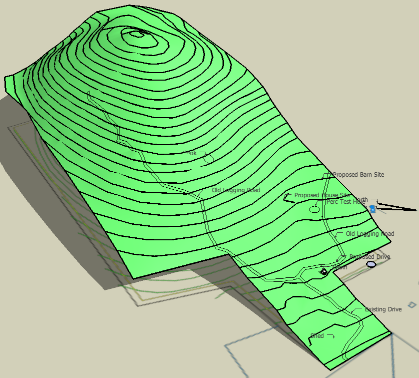
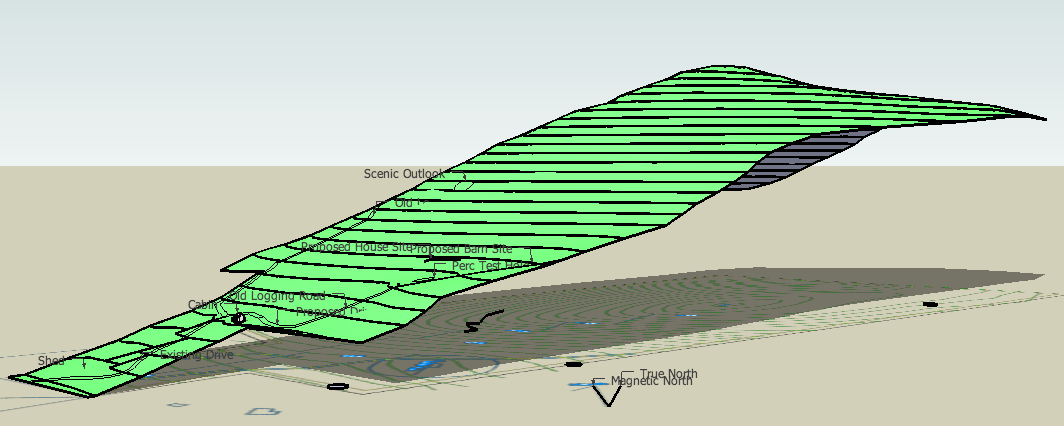
I built the 3D model (at the top of this post) of the site using SketchUp and the property survey that we currently have. Its very rough, but it gives you a good idea what the site looks like without the trees. Each contour is 20 feet. Its roughly 600 vertical feet from the bottom to the top of the hill. I’ve placed a couple of markers so you can see the location of the current cabin and the proposed site, as well as the current and proposed driveway and other points of interest.
I’ve also been doing some rough sketches of the house, but I’ll save that for a future post.
Categories
- Air sealing 13
- Appliances & Fixtures 4
- Art 3
- Award 4
- Bathroom 8
- Batteries 1
- Decor 5
- Design 10
- Electrical 5
- Energy Calculations 13
- Energy Monitors 4
- Farm 1
- Finance 1
- Flooring 3
- Foundation 9
- Framing 8
- Heating 9
- House 7
- Insulation 8
- Kitchen 6
- Landscaping 3
- Lessons Learned 1
- Performance 60
- Plumbing 10
- Porch 5
- Radon 1
- Rainwater catchment 3
- Research / study 1
- Roof 7
- Septic / Waste water 2
- Sheetrock 6
- Siding 9
- Site Work 22
- Smart home 1
- Solar 64
- Solar Obsessed 10
- Stairs 2
- Surveying 3
- Ventilation 8
- Weather 1
- Windows & Doors 14
- plug-in 3
Archive
- Jan 2021 1
- Dec 2020 2
- May 2020 1
- Jan 2020 1
- May 2019 1
- Jan 2019 3
- Sep 2018 2
- Aug 2018 2
- Jan 2018 1
- Oct 2017 2
- Apr 2017 1
- Jan 2017 1
- Oct 2016 2
- Aug 2016 1
- Apr 2016 2
- Jan 2016 2
- Nov 2015 2
- Oct 2015 1
- Jul 2015 1
- May 2015 1
- Apr 2015 1
- Jan 2015 1
- Dec 2014 1
- Nov 2014 2
- Oct 2014 4
- Sep 2014 2
- Aug 2014 1
- Jul 2014 1
- Mar 2014 3
- Feb 2014 2
- Jan 2014 2
- Nov 2013 1
- Oct 2013 1
- Sep 2013 1
- Jul 2013 3
- Apr 2013 3
- Jan 2013 3
- Dec 2012 2
- Nov 2012 3
- Oct 2012 1
- Sep 2012 3
- Aug 2012 3
- Jul 2012 2
- Jun 2012 1
- May 2012 3
- Apr 2012 2
- Mar 2012 4
- Feb 2012 4
- Jan 2012 5
- Dec 2011 4
- Nov 2011 9
- Oct 2011 10
- Sep 2011 9
- Aug 2011 6
- Jul 2011 6
- Jun 2011 12
- May 2011 8
- Apr 2011 4
- Mar 2011 5
- Jan 2011 6
- Dec 2010 9
- Nov 2010 3
- Oct 2010 4
- Sep 2010 6
- Aug 2010 8
- Jul 2010 6
- Jun 2010 3
- May 2010 3
- Apr 2010 1
- Mar 2010 3
- Feb 2010 3
- Dec 2009 1
- Jun 2009 1
- May 2009 1
- Feb 2009 1
- Dec 2008 1
- Nov 2008 1
- Jun 2008 1